Satellite Photos Confirm Damage to Third Seim River Bridge in Kursk Oblast
The third bridge over the Seim River in Kursk region was damaged as a result of shelling by the Ukrainian Defense Forces. The relevant satellite images were published by the well-known analyst MT Anderson on his page on X (formerly Twitter). The bridge is located near the village of Karyzh, Glushkovsky district, Kursk oblast of the Russian Federation.
The satellite images are dated August 20, 2024:
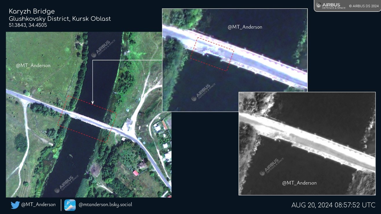 The result of the damage to the bridge over the Seim River near the village of Karyzh, Kursk region. Photo credits: x.com/MT_Anderson
The bridge is not completely destroyed, but as MT Anderson suggests, the transportation of heavy equipment and machinery is risky. At high resolution, the damage is visible across the bridge profile:
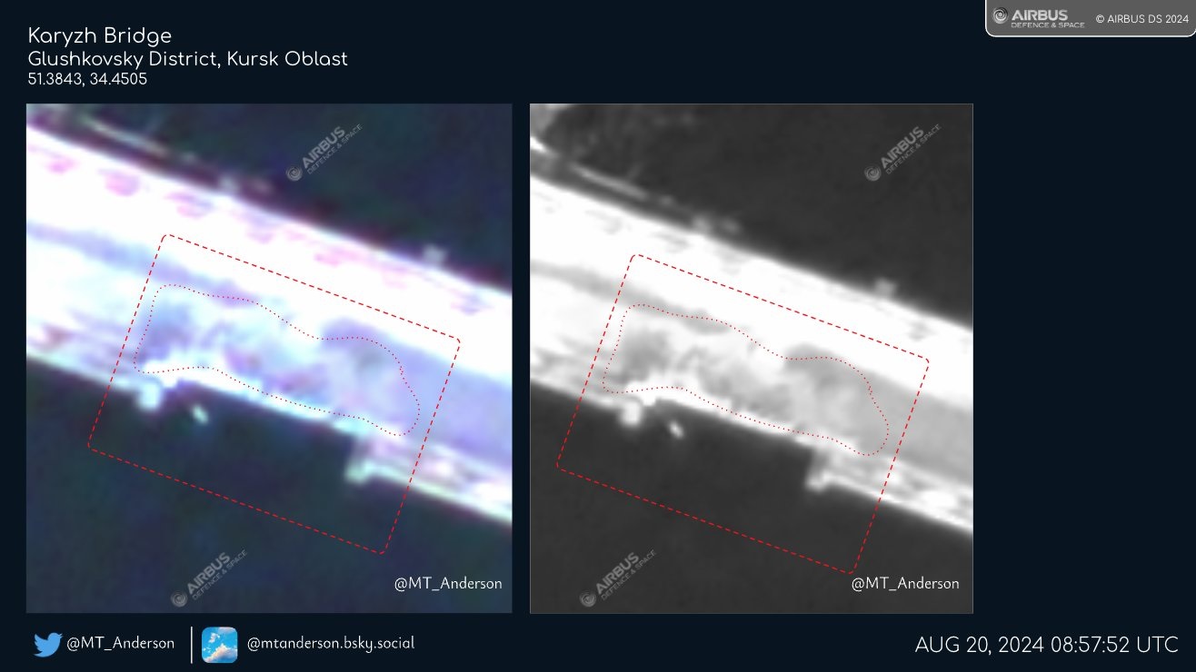 The result of the damage to the bridge over the Seim River near the village of Karyzh, Kursk region.
Photo credits: x.com/MT_Anderson
The news of the bridge's damage became known on August 19, 2024 from a statement by Russian propagandist Vladimir Romanov, who published this information on his Telegram channel, Romanov Light. Then he reported the bridge as destroyed:
 Romanov's statement on the destruction of the bridge near the village of Karyzh
The bridge is located in the Kursk oblast in the Russian part of the Seim River, and two other bridges (No.
1 and No.
2) near it have already been destroyed:
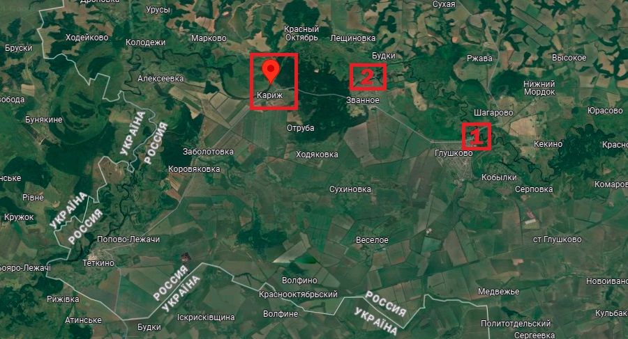 Location of the damaged bridge over the Seim River near Karyzh
The road bridge near the village of Karyzh was constructed slightly below the river level and separated from it by bumpers and fences. It had a single lane in each direction and appeared as follows in 2012:
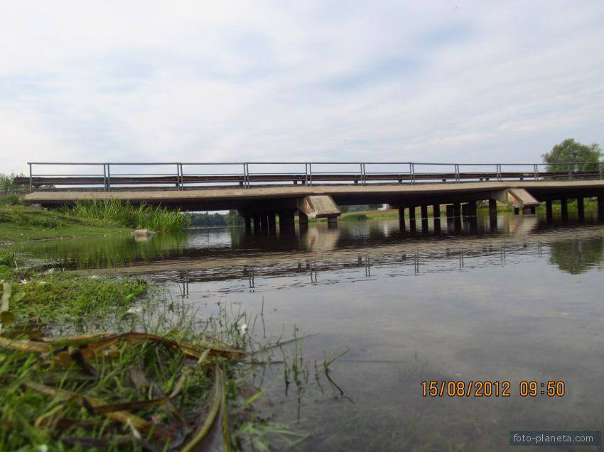 Road bridge near the village of Karyzh.
Photo credits: foto-planeta.com
Thus, all three road bridges over the Seim River near the area where the Ukrainian Defense Forces are conducting the operation were targeted. The first, located near the village of Glushkovo, was destroyed on August 16, 2024, and the second, located near the village of Zvannoye, was hit on August 18, 2024, and as a result, the movement of any equipment was impossible. Most likely, the bridges are being hit in order to complicate the supply of the Russian border group between the Russian village of Tyotkino and the Ukrainian Defense Forces-controlled area.
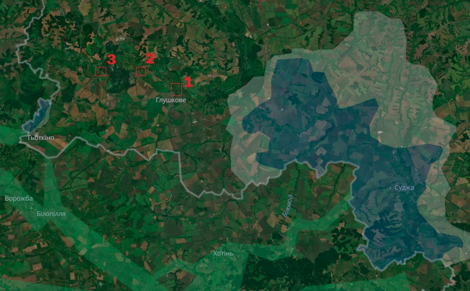 Damaged bridges in the Kursk region on the map of territory control according to the Deepstate service
This reduces the ability of Russian military formations to shell Ukrainian border areas.